Key Takeaways
- They are two different headlands in the same reserve. Both sit inside the Cape of Good Hope section of Table Mountain National Park, about 2 km apart — you can see one from the other, and one entrance fee covers both.
- The Cape of Good Hope is the most south-western point of Africa — a low, rocky headland famous for its sign, first rounded by Bartolomeu Dias in 1488.
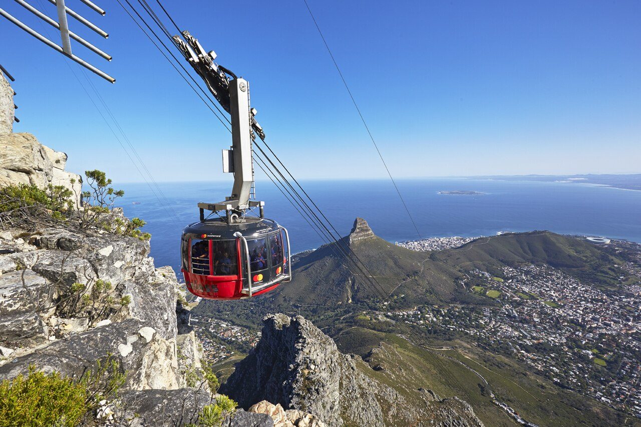
- Cape Point is the dramatic high-cliff promontory with two lighthouses, panoramic views and the Flying Dutchman Funicular — the more spectacular vantage point.
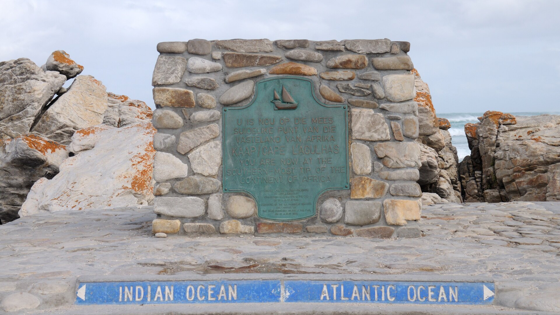
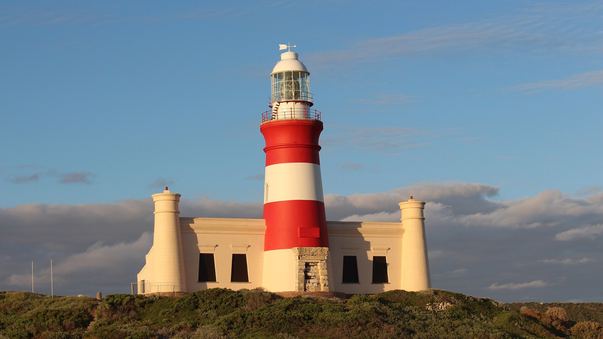
- Neither is the southernmost point of Africa — that is Cape Agulhas, about 150 km to the east-southeast, and it is also where the Atlantic and Indian Oceans are officially considered to meet.
- 2025 entrance fee (one ticket, both capes): roughly R460 adult / R230 child for international visitors; far less for SADC and South African ID holders. The park is cash-free — card only.
- The Flying Dutchman Funicular is a separate fee (about R110 return, adult) — optional, since you can walk up.
- You can comfortably see both in one day; the smart move is an anti-clockwise Cape Peninsula loop that also takes in Boulders penguins, Chapman's Peak and the fishing harbours.
TL;DR: "Cape Point vs Cape of Good Hope" is one of the most-asked questions about a Cape Town day out — and the answer is simpler than most people expect. They are two separate headlands inside the same reserve, about two kilometres apart. The Cape of Good Hope is the south-western tip of the African continent — a low, wind-scoured rocky point with the famous wooden sign. Cape Point is the higher, more dramatic promontory next door, crowned by two lighthouses and served by the Flying Dutchman Funicular, with the peninsula's best panoramic views. You do not have to choose: one entrance fee covers both, and you can see them in the same morning. Just don't believe the two big myths — this is not the southernmost point of Africa (that's Cape Agulhas), and this is not where the Atlantic and Indian Oceans meet.
Few place names in South Africa carry as much romance as Cape Point and the Cape of Good Hope. They conjure storms and sailing ships, the edge of a continent, the meeting of oceans. And few place names are as thoroughly muddled. Ask ten first-time visitors what the difference is and you'll get ten different answers — most of them wrong. Are they the same place with two names? Is one the southern tip of Africa? Is that where the two oceans crash together? The confusion is understandable, because the two capes sit almost on top of each other, share a single entrance gate, and are marketed together on every peninsula tour poster in the city.
So let's settle it properly. This guide gives you the real, unvarnished difference between Cape Point and the Cape of Good Hope, the part almost every top-ranking article skips — exactly what it costs in 2025 — and a practical plan to see both in a single, unhurried day. We run this route constantly as part of our Cape Peninsula tour, so what follows is the information we actually give our own guests, not a tourist-brochure gloss.
Cape Point vs Cape of Good Hope: The Real Difference
Here is the single sentence that clears up most of the confusion: Cape Point and the Cape of Good Hope are two distinct headlands, roughly two kilometres apart, that both lie inside the same protected area — the Cape of Good Hope section of Table Mountain National Park. They are not two names for the same place, and they are not in different parks. They are neighbours.
Because they share a reserve, they also share an entrance gate, an entrance fee and a road network. Once you're through the gate on the M65, a single loop of tarmac takes you to both — the Cape of Good Hope turn-off first, then the Cape Point car park a couple of minutes further on. From the elevated viewpoints at Cape Point you can actually look back and see the Cape of Good Hope jutting out to the west; from the Cape of Good Hope you can see the high cliffs of Cape Point rising to the east. They are that close.
So what makes them different? Character and geography:
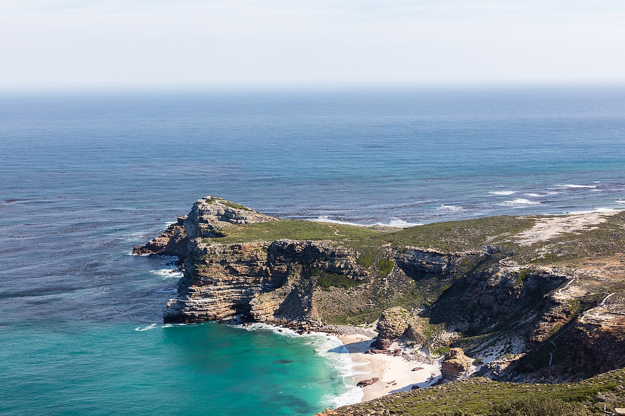
- The Cape of Good Hope is the most south-western point of the African continent. It is a relatively low, flat, rocky headland — dramatic in a raw, wind-blasted way, with pounding surf and the famous brown-and-white sign that everyone queues to photograph. Its fame is historical: this is the cape that terrified and then tantalised centuries of sailors.
- Cape Point is the higher, sharper promontory just to the east. It rises in steep cliffs to a rocky peak topped by a lighthouse, and it delivers the panoramic, vertigo-inducing views the peninsula is famous for. Its appeal is scenic and dramatic — this is where you get the "edge of the world" feeling.
If you only remember one thing: the Cape of Good Hope is the historic tip; Cape Point is the scenic viewpoint. One is about where you are standing on the map of Africa; the other is about the view once you get up high. Most people want both — and, happily, both come with the same ticket.
Quick orientation: Enter via the main gate on the M65. The Cape of Good Hope car park and sign are reached by a short right-hand turn; Cape Point (with the funicular and lighthouses) is at the end of the main road. Walking trails also connect the two along the clifftops for those with time and energy.
The Cape of Good Hope: Africa's South-Western Tip
The Cape of Good Hope is one of the most storied geographical features on Earth, and its fame far outstrips its modest appearance. Physically, it is a low, rugged, rock-strewn headland pounded relentlessly by the cold Atlantic. There is no towering cliff here, no soaring lighthouse — just the raw meeting of land, wind and sea, and the iconic weathered sign reading "Cape of Good Hope — the most south-western point of the African continent." That sign is comfortably the most photographed object in the entire reserve, and there is very often a good-natured queue for the shot.
The cape's importance is historical. It was first rounded by the Portuguese navigator Bartolomeu Dias in 1488, a voyage that finally proved a sea route from Europe to the riches of the East was possible. Dias reputedly called it the "Cape of Storms" — an honest name, given the ferocity of the weather here — but the Portuguese king renamed it the Cape of Good Hope, because rounding it opened the hopeful prospect of a trade route to India. For the next three and a half centuries it was one of the most important and most feared waypoints in global navigation. Standing on the rocks with the wind trying to knock you sideways, it is easy to feel the weight of that history.
Beyond the sign, the Cape of Good Hope headland rewards a short walk. A path climbs to a viewpoint over the point itself, and nearby lies Dias Beach — a stunning, secluded strip of white sand wedged in the ravine between the Cape of Good Hope and Cape Point, reached by a long wooden staircase (a proper leg workout on the way back up). The surf here is wild and the water bracingly cold; it is a place for photographs and awe rather than swimming. The whole headland is cloaked in low, salt-pruned fynbos, and it is common to see ostrich, small antelope and, unfortunately, opportunistic baboons in the car park.
A word many visitors get wrong: the Cape of Good Hope is not the southern tip of Africa, and it is not where two oceans meet. It is the south-western tip. We bust these myths in detail further down — but it is worth planting the flag here, because the misunderstanding shapes how people experience the place.
Cape Point: Cliffs, Lighthouses & the Flying Dutchman
If the Cape of Good Hope is about history, Cape Point is about drama. This is the tall, sheer promontory that gives the peninsula its "end of the continent" grandeur — jagged cliffs plunging some 200 metres to a churning sea, with views that stretch across False Bay to the mountains beyond. On a clear, wind-scrubbed day, the panorama from the top is among the finest coastal views anywhere in the world.
Crowning the peak is the original Cape Point lighthouse, completed in 1860 (first lit in 1860 after construction from 1859). It stands at 238 metres above sea level — and therein lay its fatal flaw. It was built so high that it was frequently shrouded in cloud and mist, rendering it useless to the very ships it was meant to guide, and it stood too far back to warn vessels off the treacherous rocks below. After the tragic wreck of the Portuguese liner Lusitania on Bellows Rock in 1911, a new, lower lighthouse was built closer to the sea and first lit in 1919. It is the most powerful lighthouse on the South African coast. The old lighthouse, meanwhile, became the perfect viewpoint — and today it is the destination of the classic Cape Point walk.
Getting up to the old lighthouse is part of the fun, and here you have a choice:
- Walk it. A steep, paved footpath climbs from the car park to the old lighthouse in about 10–15 minutes. It is a genuine uphill effort but entirely manageable for anyone reasonably mobile, and the views open up with every step.
- Ride the Flying Dutchman Funicular. This charming little funicular railway — named after the legendary ghost ship said to haunt these waters — carries you most of the way up in a couple of minutes. From the upper station it is a short, easy walk to the old lighthouse. It is the perfect option for anyone who would rather save their legs, and it is wheelchair-accessible to the upper viewing area.
At the base of Cape Point you'll find a curio shop, the well-regarded Two Oceans Restaurant (with a knockout view over False Bay), restrooms and information boards. From the upper viewpoints, walking trails fan out along the clifftops — including the path that links across to the Cape of Good Hope for the energetic. This is the spot for the photograph everyone comes for: the vertiginous drop, the two oceans of blue stretching to the horizon, and the sense of standing right at the tip of a continent.
Entrance Fees & Costs (2025): Exactly What You'll Pay
This is the part almost every other guide leaves out — and the part that matters most when you're planning. Here is the honest cost breakdown for 2025. One entrance fee covers the entire reserve — both the Cape of Good Hope and Cape Point. You do not pay twice.
Fees are reviewed annually by SANParks (typically effective 1 November) and rise modestly each year, so treat these as close 2025 guide figures and confirm the exact rate on the day. Prices shown in South African Rand.
The Flying Dutchman Funicular at Cape Point is a separate, optional fee — it is not included in the entrance ticket:
- Return (round trip): about R110 adult / R55 child
- One way: about R90 adult / R50 child
- Children under 6: ride free
Three practical money notes that catch visitors out:
- The park is cash-free. Both the entrance gate and the funicular accept card payment only — bring a working bank or credit card. There are no cash tills.
- The Wild Card covers entry. If you hold a SANParks Wild Card, your reserve entrance is included (the funicular still costs extra).
- A tour usually bundles the fee in. On a guided Cape Peninsula tour the entrance fee is typically included in the price, so you don't queue or fuss with the gate — worth factoring in when you compare the true cost of going it alone versus being driven.
Opening hours shift with the season: roughly 06:00–18:00 in summer (October–March) and 07:00–17:00 in winter (April–September), with last entry an hour or so before closing. Arriving early is the single best free upgrade you can give yourself — you'll beat the tour-bus crush at the sign and the funicular, and the light is better for photographs.
How to See Both in One Day: The Perfect Route
You absolutely do not have to choose between Cape Point and the Cape of Good Hope — and you shouldn't. Both are inside the same reserve, minutes apart, and covered by the same ticket. Seeing both in one visit is not just possible; it is the whole point. Budget around two to three hours inside the reserve if the capes are your focus, or fold them into a full-day loop of the entire peninsula.
The smart approach is an anti-clockwise Cape Peninsula loop. Here's why direction matters: driving anti-clockwise puts you on the ocean side of the road for the most spectacular stretches, makes the viewpoint pull-offs easier, and — crucially — gets you to the reserve gate ahead of the mid-morning tour-bus wave if you leave the city early.
A classic full-day anti-clockwise itinerary looks like this:
- Leave Cape Town early and drive down the Atlantic seaboard through Hout Bay.
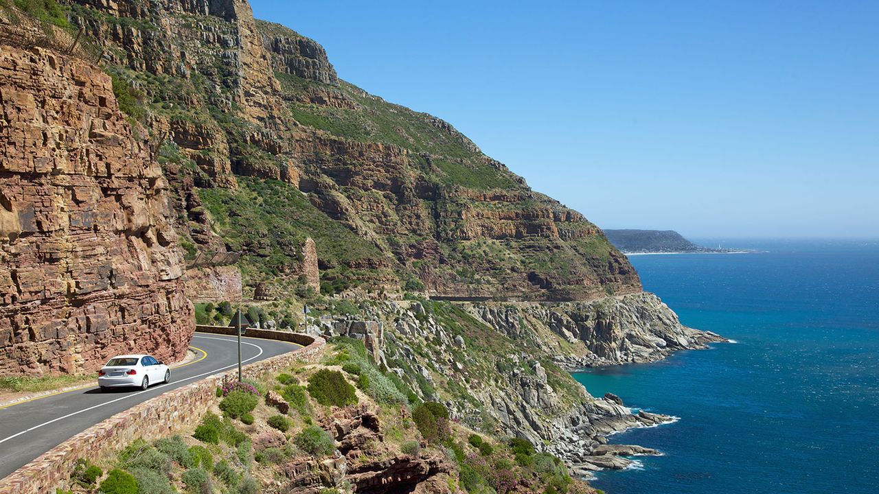
- Chapman's Peak Drive — one of the world's great coastal roads (small toll; worth every cent) to Noordhoek.
- Enter the reserve via the M65 and Scarborough side, arriving before the crowds.
- Cape of Good Hope first — photograph the sign, walk the headland, feel the wind.
- Cape Point next — funicular or walk up to the old lighthouse for the big views; lunch at the Two Oceans Restaurant if you like.
- Boulders Beach on the way back — meet the African penguin colony (see our Boulders Beach penguins guide).
- Simon's Town and Kalk Bay — harbour villages for coffee, seafood or browsing before the drive home along False Bay.
If your time is tight and the capes are all you want, you can do a leaner version: straight down the M3 and M65, into the reserve, both capes, and back — comfortably a half-day. But the peninsula is one of the most beautiful drives on the planet, and rushing it is a small tragedy. Our full-day Cape Peninsula tour is built precisely around this anti-clockwise flow, and a private guide handles the gate, the timing and the best-light stops so you simply enjoy the ride.
Wildlife, Fynbos & Views
The reserve is far more than two famous rocks. It protects a slice of the Cape Floral Kingdom — the smallest and most concentrated of the world's six floral kingdoms, and a UNESCO World Heritage feature — carpeting the headlands in fynbos, the fine-leaved, wildly diverse shrubland found nowhere else on this scale. In spring, the low heath erupts with proteas, ericas and countless wildflowers, humming with sunbirds.
The reserve's most conspicuous residents include bontebok and eland (both reintroduced), Cape mountain zebra, red hartebeest, grysbok and — memorably for many visitors — free-ranging ostrich, which you'll often see striding through the fynbos near the coast. Offshore, whales (southern right and humpback) pass close by in season, seals bob in the kelp, and the birdlife is superb, from cormorants and oystercatchers to birds of prey riding the updraughts along the cliffs.
⚠️ The baboon warning — take it seriously. The reserve is home to troops of chacma baboons, and the ones near the car parks have learned to associate humans with food. They are strong, bold and can be aggressive when they smell a snack. Never carry visible food or drink, keep car windows up and doors locked when parked, and never, ever feed them — a fed baboon is a dead baboon, as it eventually has to be destroyed. Enjoy them from a respectful distance and secure your belongings.
For views, the hierarchy is clear: Cape Point delivers the grand panoramas from the old lighthouse — False Bay curving away to the east, the surf line far below, and the Cape of Good Hope pointing out to the west. The Cape of Good Hope gives you the raw, sea-level intensity of the continent's edge and the best angle on Dias Beach. Photographers should aim for early morning (softer light, fewer people) or late afternoon; the midday sun and wind can be harsh. For a broader sense of how these viewpoints stack up against the rest of the region, see our Table Mountain, Cape Point & Peninsula tours guide.
Myths Busted & Booking
Two persistent myths cling to this corner of the map, and clearing them up will make your visit richer.
Myth 1: "Cape Point / the Cape of Good Hope is the southernmost point of Africa." It isn't. The southernmost point of the African continent is Cape Agulhas, about 150 km to the east-southeast. The Cape of Good Hope is the most south-western point — an important distinction. It looms so large in history and imagination because it was the great turning point for ships sailing between the Atlantic and the Indian Ocean, not because it is the bottom of the map.
Myth 2: "This is where the Atlantic and Indian Oceans meet." Also no. There is no fixed line in the sea, and the officially recognised meeting point of the two oceans is at Cape Agulhas, not here. What you do experience at Cape Point is the mingling of two great currents — the cold Atlantic Benguela and the warmer Agulhas — whose boundary shifts with season and weather somewhere between Cape Point and Agulhas. The "Two Oceans" name you'll see on the restaurant and the aquarium is a lovely bit of Cape marketing rooted in that current-mixing reality, not a literal geographic seam you can stand over.
A few smaller misconceptions worth retiring: you don't have to pick one cape over the other (one ticket, both); the funicular is optional, not compulsory (you can walk); and the reserve is genuinely wild — the weather turns fast, the wind bites, and layers plus a windproof jacket are wise even on a sunny Cape Town morning.
The easiest, most rewarding way to visit is with a private guide who knows the reserve's rhythms — when to hit the sign before the buses, which viewpoint catches the best light, where the ostriches graze and how to weave the capes into the wider peninsula. Beyond Africa Safaris runs this as a relaxed, private, full-day experience: door-to-door transport, entrance fees handled, Chapman's Peak, both capes, Boulders penguins and the harbour villages, all at your pace. Explore our Cape Peninsula tour, our best Cape Town tours roundup, or the full ultimate Cape Town tours guide for 2026 to see how it all fits together.
Plan Your Private Cape Point & Cape of Good Hope Day
Beyond Africa Safaris runs private, full-day Cape Peninsula tours that take in both Cape Point and the Cape of Good Hope — with entrance fees handled, Chapman's Peak, Boulders penguins and the fishing harbours woven in, all at your own pace. We'll build the day around the light, the tides and your interests.